Best way to find and navigate off-road MTB routes

vandalbulldog

Pedelecer
Aug 23, 2017
70
18
49
Bingley
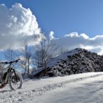
As per the title really, where does everyone get the best routes from and what kit can you but to guide you around??

Sent from my SM-A510F using Tapatalk
 

Russelliow

Pedelecer
Apr 14, 2017
95
15
35
iom
Os 1:25000 map or sometimes osmand app on my phone. I've not plucked up the courage to spend £500 on a GPS and then buy £200 maps for it

Sent from my TA-1033 using Tapatalk
 
  • Agree
Reactions: Gringo

Gubbins

Esteemed Pedelecer
My Garmin offers a round trip function. You just give it a direction and tell it how many miles you want to ride.
Not tried it yet but will someday when I have the time.
I didn't have to pay any extra for maps either (Edge Explore 1000).
Strava Labs have a global heat map but you cant isolate road from off road, although its good at the route planning stage..
 

vandalbulldog

Pedelecer
Aug 23, 2017
70
18
49
Bingley
My Garmin offers a round trip function. You just give it a direction and tell it how many miles you want to ride.
Not tried it yet but will someday when I have the time.
I didn't have to pay any extra for maps either (Edge Explore 1000).
Strava Labs have a global heat map but you cant isolate road from off road, although its good at the route planning stage..
Will the round trip route you back to a road or does it consider tracks / bridalwats etc...

Sent from my SM-A510F using Tapatalk
 

Nealh

Esteemed Pedelecer
Aug 7, 2014
20,124
8,224
60
West Sx RH
I have the Edge touring the round trip routing I have never tried off road and the on road routing takes me on roads I prefer not to use. Using open street maps with Garmin you can plot any course and upload it to your device, them simply follow the route for a free flowing ride with out the need to stop and look at maps. Also with Garmin you can upload other users courses to your device if you like the look of them.
 

Ballynoes

Esteemed Pedelecer
Jul 13, 2017
257
146
Perthshire Scotland
You can use Strava. Plot the route on the computer and then use you phone to navigate.


I use a Garmin etrek30, was about £120 (use it for various hobbies). Anyway I plot the routes on the computer, using Strava maps, google earth etc, then download the GPX files to my Garmin, easy done. I just set off and follow the coloured line on the GPS, as long as I follow the line, I know I am guaranteed to get back to my car/start point.


Words of caution though. If you plot the routes on any kind of maps or GPS, you sometimes come across anomalies, like.... there isn't a bridge, and it's a long way back, or a wade through carrying your bike. Or the field is full of cows. As long as you are aware you can have a plan B.


There are also plenty sites which others have documented their rides, and you can copy one of those or modify as you want.


I like to use Google earth, look for something interesting to see and plot a route to and from it.


Good Luck.
 
  • Like
Reactions: topographer

davell

Pedelecer
Jun 6, 2017
154
64
Doncaster
I’ve been trying an app called ‘komoot’ which I’m finding to be quite good. Available on iOS and Android. You can select your discipline (mountain bike, road bike etc) and the routes used are then biased towards this. You can plan routes at home and then make the routes available offline in case you have poor mobile internet. I then use my iPhone as the navigation device mounted on the bike. You get one map region for free which in my case covers a good area. You can then purchase other regions or the entire uk as required.


Sent from my iPad using Tapatalk
 
  • Like
Reactions: topographer

BazP

Esteemed Pedelecer
Oct 8, 2017
358
174
74
Sheffield
I use MemoryMap os25k maps on my phone. The App is free but you pay for the maps. Its the only thing I've found that differentiates between private tracks, footpaths and bridleways. Two of which you shouldn't be on. Riding across a greyed out space is not much good. I look at Google Sat view to check on the state of some tracks but again it doesn't tell you if they are private. Using footpaths becomes a problem if you come to a high stile with a 23kg bike.
 

Blaque

Finding my (electric) wheels
May 25, 2016
14
20
57
Scottish Borders
I'm using ViewRanger. Free phone app and website, but you need to purchase the OS maps. But this is done by grid squares so that you can just buy the bits you need. Suggests routes from your present location. You can download routes on the phone or website prior to going and follow the route. Or just record where you have been and create a route from that.
The Strava website is good for finding tracks. But I find that you have to zoom in and out for them to start appearing. Then if the track is in a wood it is only a red line in a grey square and you have to have a bit of local knowledge to find it.
 
  • Like
Reactions: topographer

topographer

Esteemed Pedelecer
May 13, 2017
559
216
Mid Yorkshire
Not allowed on footpaths. Allowed on bridleways
Yeah but what about those 'Public Footpath' signs you see out in the countryside which go across farm fields and so on? If I can't go on them I may as well hang up my bike. They are the most interesting routes. I don't go on narrow paths where I may block others getting through.
 

Gubbins

Esteemed Pedelecer
Yeah but what about those 'Public Footpath' signs you see out in the countryside which go across farm fields and so on? If I can't go on them I may as well hang up my bike. They are the most interesting routes. I don't go on narrow paths where I may block others getting through.
Following those signs will inevitably lead to some sort of stile or other blockage that will be difficult to navigate with a heavy bike. Bridleways are surprisingly abundant if you can find them. The horsey set like to get about..
 

BazP

Esteemed Pedelecer
Oct 8, 2017
358
174
74
Sheffield
Yeah but what about those 'Public Footpath' signs you see out in the countryside which go across farm fields and so on? If I can't go on them I may as well hang up my bike. They are the most interesting routes. I don't go on narrow paths where I may block others getting through.
Apart form the obvious stile problem it is illegal in England to ride on a public footpath. On bridleways there will be gates for you to pass. I fully agree with this ruling and any attempt to cycle on paths across farmland will only cause aggravation with farmers and walkers and not do the cyclist's cause any good.
Get a good map and look for bridleways, green lanes, canal tow paths and forest tracks. Around my area I can easily cycle 30 miles without having to go on a road.
 
  • Agree
Reactions: Gringo

Related Articles

Advertisers