Hi,
I’m aware of cycleroute.org, (currently out of service) and Google Maps cycle mode but can anyone recommend or provide a net link, (or Android app link), for an application that can intelligently offer alternate routes to circumnavigate or work around hills on an entered original route.
I’m not interested in apps or sites that merely show profile elevation of an entered route. I’d prefer an application that can automatically calculate routes to iron out hills or promontories.
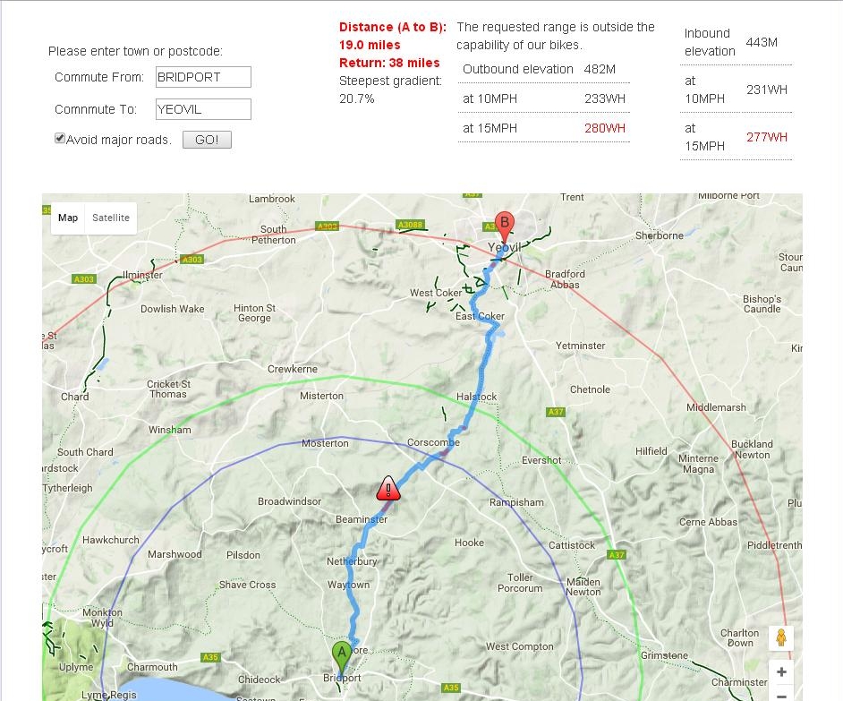
I currently enjoy my own West Dorset hills and have little issue in navigating them but this request is based on seeking an efficient route from A to B if, for example, I wished to deduce the least hilly route to travel from Bridport to Yeovil or Bridport to Axminster or Dorchester.
I don’t need lists of arithmetic or geometry. I just need a recommendation, (a link or an app), that might meet my needs.
Thanks.
I want to plan routes of up to 20 miles, without putting more strain on my, (reasonably fit but failing), 60 year old body than my doctor would recommend.
Thus … can anyone point me to a useful, elevation based cycle route planner that accomodates or works around hills?
Alternately, has anyone come across a decent, online based, sea level map tool that floods a 3d Google Earth style map … to achieve a similar, though only visual, version of a ‘hill avoider’.
I’m aware of cycleroute.org, (currently out of service) and Google Maps cycle mode but can anyone recommend or provide a net link, (or Android app link), for an application that can intelligently offer alternate routes to circumnavigate or work around hills on an entered original route.
I’m not interested in apps or sites that merely show profile elevation of an entered route. I’d prefer an application that can automatically calculate routes to iron out hills or promontories.
I currently enjoy my own West Dorset hills and have little issue in navigating them but this request is based on seeking an efficient route from A to B if, for example, I wished to deduce the least hilly route to travel from Bridport to Yeovil or Bridport to Axminster or Dorchester.
I don’t need lists of arithmetic or geometry. I just need a recommendation, (a link or an app), that might meet my needs.
Thanks.
I want to plan routes of up to 20 miles, without putting more strain on my, (reasonably fit but failing), 60 year old body than my doctor would recommend.
Thus … can anyone point me to a useful, elevation based cycle route planner that accomodates or works around hills?
Alternately, has anyone come across a decent, online based, sea level map tool that floods a 3d Google Earth style map … to achieve a similar, though only visual, version of a ‘hill avoider’.
Last edited: