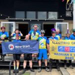
are there any electric bike rides or meet's before christmas?
- Thread starter monster
- Start date
If it's reasonably close to where I live (south london), and it's not raining on the day, then I'd be up for it.hi
I have my bikes sorted out now, the way i want them. are there any electric bikes rides or events before christmas? or does any one want to go for a long distance ride somewhere?
I also have satnav, so never get lost... I just miss turnings instead ")
What are you using? My favorite so far has been mgmaps with the opencyclemaps downloaded and stored on an SD card (because you can never get a data connection when you're lost in the middle of nowhere) - I much prefer the opencyclemap mapping to the regular ones. Even though mgmaps doesn't have route planning, I don't really miss it.
I'd like to see some new roads/trails, so would prefer it if you chose the route... or we pick a random station not too far away as the start/end point and just sketch out 15 miles on bikehike.co.uk. What sort of terrain do you like? road/cyclepath/off-road ? etc
I will be based in East Sussex, 45 minutes by car to Gatwick, 1h by train to London Bridge. Proper off-road is excluded for me but I wouldn't mind some country-side trails or quiet lanes. My preference would be for a ride on the southern coast (e.g. Eastbourne, Beachy Head, Birling Gap, Cuckmere Heaven, etc.) but that's probably a bit far.
How about one of the rides off the Cuckoo Trail (from Heathfield to Polegate). The council helpfully provides four rides of about the right length... and it's not too unreasonable to get to by train or car for us southerners.
http://www.eastsussex.gov.uk/NR/rdonlyres/FBA5D3C6-EEE3-42CF-8E3D-3F89959BDC8E/0/cuckoo_trail_leafletprint.pdf
http://www.eastsussex.gov.uk/NR/rdonlyres/FBA5D3C6-EEE3-42CF-8E3D-3F89959BDC8E/0/cuckoo_trail_leafletprint.pdf
Last edited:
Whatever the outcome of the pre-Christmas ride is, I would definitely be taking part in a Cuckoo Trail tripHow about one of the rides off the Cuckoo Trail (from Heathfield to Polegate). The council helpfully provides four rides of about the right length... and it's not too unreasonable to get to by train or car for us southerners.
http://www.eastsussex.gov.uk/NR/rdonlyres/FBA5D3C6-EEE3-42CF-8E3D-3F89959BDC8E/0/cuckoo_trail_leafletprint.pdf
By the way, route 21 is viewable online:
OpenCycleMap.org - the OpenStreetMap Cycle Map
Oh, and Fecn's very own report about this kind of ride:
http://www.pedelecs.co.uk/forum/electric-bicycles/4179-what-wonderful-day-part-2-route-21-ride-electric-eastbourne.html?highlight=rotherfield#post54025
Related Articles
-
 MTF Enterprises announces acquisition of EMU Electric Bikes
- Started by: Pedelecs
-
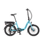 Wisper 806T folding bike wins Which? ‘Best Buy’
- Started by: Pedelecs
-
 Sustrans calls for protected cycle lanes
- Started by: Pedelecs
-
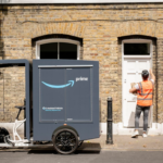 Amazon launch their first UK e-cargo micromobility hub
- Started by: Pedelecs