Harwich - Hook of Holland - Amsterdam

rustic

Esteemed Pedelecer
May 31, 2008
288
42
North Essex
Hi,

I have a bit of free time off work, I'm very tempted to take myself over to Amsterdam on my Alien GSII via the Harwich - Hook of Holland Ferry. Has anyone made this trip before and got any tips? My preference would be for a more coastal / rural route avoiding major roads wherever possible. :)
 

MAB

Pedelecer
May 12, 2010
66
0
Cycle City UK aka Cambridge
Hi Rustic,

LF1 from the Hook of Holland to Zandvoort/Haarlem and then LF20 to Amsterdam! No, I haven't done the route myself yet but, I shall be doing parts of that route in September!:D

Lots of information on the net, mostly in Dutch though, for a general overview OpenCycleMap.org - the OpenStreetMap Cycle Map is a good start, well it will give you a few pointers. I am sure that the Dutch tourist offices (VVV) have cycle maps in English, so you could pick one up when you get there or someone else here may know where to buy maps in this country.

EDIT. Holland Maps - The Official Website of The Netherlands Board of Tourism & Conventions Sell cycleway maps @£7.50 each! :eek: !! If you feel so inclined to go this route (pun not intended!) ;) you will need the maps covering Zuid (South) Holland and Noord (North) Holland-South.

Nice new ferries on the route now!

Hope this helps?

regards,

Mike.
 
Last edited:

HittheroadJ

Pedelecer
Apr 22, 2010
152
16
Northern Ireland, BT1
Holland is excellent for cycling.

There are good itinerary descriptions on:
Bicycling the North Sea Route (starts much further south. But does contain coastal route from Hoek van Holland to Zandvoort).

The link above refers to the LF1 (Lange fietsroute 1 which goes from the North (Den Helder to Bpulogne sure mere in France))
If you happen to own and use a gps you can download GPS-coordinates of the route from Noordzeekanaal to Hoek van Holland from this page
GPStracks - GPS langeafstand fietsroutes in Nederland in the list you would use numbers 3 and 4.

On that page is also a link to the google-map of the route (LF1 Noordzeeroute) and to a google-earth kml file.

There are also links to books of the route, but they will be in Dutch.

Hope this helps.
 

rustic

Esteemed Pedelecer
May 31, 2008
288
42
North Essex
Excellent information, many thanks to you both. I'm just compiling information & hope to make the trip perhaps early in July.

Many thanks.
 

piotrmacheta

Esteemed Pedelecer
Jun 23, 2009
316
0
Sounds like a great trip.
Does anyone know if you can get a GPS like Satmap that has all the cycling lanes and links to minor roads?
 

HittheroadJ

Pedelecer
Apr 22, 2010
152
16
Northern Ireland, BT1
Cycling GPS Sat Nav Systems has some cyclists satnavs.

You can buy maps for them or just copy waypoints, tracks and routes from sites.

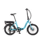
There are specific satnavs for motorbikes that are waterproof etc. But they cost a lot and expect to use power from the battery. I do not think there are satnavs like that for bikes.

What I have used in the past are 2 possibilities:
1. Use a car-satnav set it to pedestrian and pick the routes you like best and let the satnav recalculate. It is easy and cheap and works well. I have a Garmin Nuvi with European maps. Means that you will always find the campsite back. Handy if you did not plan anything and just go for a short trip for fun.
2. Use a GPS for cyclists like above. I would use oziexplorer to select the routes and then upload the points and routes into the GPS and fit the GPS in a clamp on the bike. The advantage is that you will follow exactly the path stipulated in the books and it does give very good indications of where you are, how far it is etc. For longer journeys a GPS will keep out the moist, run 1 or several days on AA or AAA batteries and allow you to later import the logs/tracks so you see exactly where you've been etc. I would also upload some touristy info (campsites, bike-repair-shops, other lodgings etc.) if they are not already in the GPS.

For a trip like rustic's I would not use a car-satnav but a weatherproof one that runs on AA or AAA batteries because they are more practical. In his case I would download the coordinates of the trip as mentioned in the books etc. and some other info. While riding the bike the occasional glance would tell me whether I was on the right track and where to go.

The North-Sea coast route has a lot of paths through the Dunes and nature areas.

The additional information I would just look up on google-maps (some searches and saving points to a private map on Google-maps then download as KML and convert to a format for your GPS (with GPSBabel)).

This is just the way I do it. I have found it takes the stress out of cycling abroad. You always know exactly where your are and exactly where you need to go & how far away that is.
 
Last edited: