I'm new to e-bikes and have lots to learn...

Underlayunderlay

Pedelecer
Oct 16, 2019
37
8
Dorset
Hi all, I've already asked a few questions on here and thank you for all your help so far.

Male, 51, heavy build and likes a glass of wine or three. I could not be further away from what I perceive as a 'typical' cyclist. Just a fat bloke on a bike...trying not to fall off.

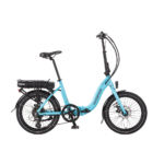
The reason for spending so much money(for me) on an Oxygen 13ah e-bike was to help with an on going back problem. It also worked as a reason my wife couldn't argue with:p..."you want me to get better don't you?"
After a few back ops I've got less strength in my right leg and so far this bike is great to get it moving albeit with the motor doing most of the work.
I also lost my job just days after buying this so after losing my company car this could be my daily transport. Can I charge it at the M3 Winchester services?

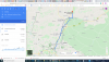
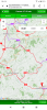
Off out today on my 1st proper ride. I've bought a helmet, mudguards and a frame bag for my phone and basic tools. I just need an app to tell me where all the bike tracks are near me. I used to do green laning and have those maps but I also don't want to get run over or meet them head on.

Any app recommendations anyone?
 
  • Like
Reactions: Brie

cyclebuddy

Esteemed Pedelecer
Nov 2, 2016
1,545
732
Beds & Norfolk
Try your local (and neighbouring) Council websites for free to download PDF's of all the cycle routes/tracks in your home county.

The national cycle route maps available across the whole of the UK are available here:

These are all good if you're looking for quieter routes (off-road/quiet road/old railway track routes converted into cycle lanes/canal paths) to get your confidence and fitness up a bit.
 
  • Like
Reactions: Underlayunderlay

Underlayunderlay

Pedelecer
Oct 16, 2019
37
8
Dorset
Try your local (and neighbouring) Council websites for free to download PDF's of all the cycle routes/tracks in your home county.

The national cycle route maps available across the whole of the UK are available here:

These are all good if you're looking for quieter routes (off-road/quiet road/old railway track routes converted into cycle lanes/canal paths) to get your confidence and fitness up a bit.
That's great cyclebuddy , I've already picked my introductory route today.
Is there anyway to follow these routes in real time as in a sta nav way? Google maps don't give a cycle option as far as I know.
 

cyclebuddy

Esteemed Pedelecer
Nov 2, 2016
1,545
732
Beds & Norfolk
I just buy paper OS maps (Explorer or Landranger) for areas I want to visit/cycle. These have cycle routes clearly marked. The paper versions are great for forward planning trips, showing at a glance a huge area so you can pick destinations and cycle stops (pubs!) in advance much more easily than on a tiny phone screen.

Once you've bought the paper version, you can download the digital version to take with you on your phone for free from the OS website, but, no, these don't plot your progress en-route either*.


* EDIT: Actually, having re-looked at the OS website, I'm wrong here. There is an OS app that allows you to track your route in real time. And there seems to be a free 7-day trial too.
 
Last edited:

Ocsid

Esteemed Pedelecer
Aug 2, 2017
441
265
81
Hampshire
If you use the "app" MAPS ME on your phone or tablet and fathom out how to ask it for a route for a "cycle", it will by and large use cycling routes as well as lower traffic use minor roads.
This app once installed does not need a phone data connection, it allows you to download local maps onto the phone's memory including any SD card. These map downloads cover wide areas so unless you are on a map edge you only need store a single map, if your storage is challenged.
This app uses the inbuilt GPS so it displays your location so you quickly realise if you have gone off route, and can see your progress.

Its my standard routing tool away from known areas, I run it on a mini 7" tablet and I have a 13,000mAh battery bank, kept in a pannier just in case a top up is needed, though my tablet is generally good on power management.
 
Last edited:

vfr400

Esteemed Pedelecer
Jun 12, 2011
9,822
3,985
Basildon
If you have a smartphone, you can use Google Navigation that's really good, or you use Google maps, choose a location, then select "directions". There's a tab where you select what vehicle you're in or on. If you select "cycling", it'll follow all the cycle paths and routes. All this is absolutely free and it works in most cases better than any proprietary nav device.

As long as that tab is set to cycling Google will show all the cycle ways. That also works on your PC. Don't forget to switch it to car if you want routes or maps for driving.
 

sjpt

Esteemed Pedelecer
Jun 8, 2018
3,642
2,652
Winchester
Male, 51, heavy build and likes a glass of wine or three. I could not be further away from what I perceive as a 'typical' cyclist. Just a fat bloke on a bike...trying not to fall off.
Replace 51 with 71 and it sounds 'typical'. Good luck with your back.

Can I charge it at the M3 Winchester services?
Probably not easily; there may be a socket at the back of the petrol part or sowewhere? How easy is it to get there by bike: maybe a way round the back from Chilandham Lane? (We often go further round behind the services, but haven't used that particular track.)

https://cycle.travel/ is a useful cycle route design site (not sure how easy is is to transfer routes). As others have said, OS map very helpful, but often difficult to tell easy bridleways from completely muddy nogos. https://maps.hants.gov.uk/rightsofwaydefinitivemap/ should have the rights of way more definitive, but is sadly out of date itself. One thing you will see is that we are particularly well of round Winchester for bridleways compared to the rest of Hampshire; also quite a few of the back roads are pretty quiet.

What sort of riding do you like? We do bridleways in summer but tend to keep to roads and made up tracks once the mud comes in.
 
  • Like
Reactions: Underlayunderlay

Nealh

Esteemed Pedelecer
Aug 7, 2014
19,990
8,172
60
West Sx RH
I use Garmin Connect to plot courses (using OS Explorer maps) and down load courses to my Touring GPS, it then follows the course and has a missed turn option to keep you on course. Great for rides without stopping to look at maps or deciding which turn to take next. I also carry OS explorer maps with me sometimes as well in case I want to make a detour off the planned course.
 

Underlayunderlay

Pedelecer
Oct 16, 2019
37
8
Dorset
Im
Replace 51 with 71 and it sounds 'typical'. Good luck with your back.


Probably not easily; there may be a socket at the back of the petrol part or sowewhere? How easy is it to get there by bike: maybe a way round the back from Chilandham Lane? (We often go further round behind the services, but haven't used that particular track.)

https://cycle.travel/ is a useful cycle route design site (not sure how easy is is to transfer routes). As others have said, OS map very helpful, but often difficult to tell easy bridleways from completely muddy nogos. https://maps.hants.gov.uk/rightsofwaydefinitivemap/ should have the rights of way more definitive, but is sadly out of date itself. One thing you will see is that we are particularly well of round Winchester for bridleways compared to the rest of Hampshire; also quite a few of the back roads are pretty quiet.

What sort of riding do you like? We do bridleways in summer but tend to keep to roads and made up tracks once the mud comes in.
I'm not sure what sort of riding I like yet? Getting off the settee and out of my car is the starting point for me. I've previously done green laning on a motorbike and would like to do a slower version of that eventually. The Winchester services was mentioned because my job(when I had one) took me up and down the M3...the bane of my life!
I'll be riding around Dorset , maybe Wimborne and surrounding.
I have a Wetherspoon app that needs abusing :D
 

vfr400

Esteemed Pedelecer
Jun 12, 2011
9,822
3,985
Basildon
Here you can see how Google maps works. three alternate routes are offered, though you can adjust any of them by pulling the nodes. It shows the inclines bottom left. You can put your cursor on the steep bits to see on the route where they are, then you can pull the nodes onto alternative routes to avoid any nasty inclines.
32511
 

Attachments

  • Like
Reactions: Underlayunderlay

cyclebuddy

Esteemed Pedelecer
Nov 2, 2016
1,545
732
Beds & Norfolk
I suppose it depends what type of cycling you're hoping to do. Google "Cycle" mapping is fine if you just need to get from A to B. If you're out for pleasure, a little exercise or fresh air, or just building your confidence and prefer quiet lanes or dedicated cycle routes, Google mapping can be a nightmare.

In one of the areas I ride, Google "Cycle" mapping suggests 3 routes between two large towns. Each of the three suggested routes mostly uses busy/hazardous roads because they're quick and direct. Yet it totally ignores 2 clearly signposted, Sustrans/Council off-road Cycle-specific routes because they're less direct, meandering as they do through green spaces along a riverside and well hidden behind and between the built-up areas. They are on Google mapping if you know they're there and you look for them, but they ain't very obvious and you need to look hard for them.

In general, I've found Google "Cycle" mapping completely bypasses huge sections of suggested quiet/dedicated Cycle routes because they're less direct (despite being far more scenic/enjoyable to ride). Google also fails to show there are several alternative/deviation routes taking in other recommended cycle paths simply because you didn't ask (and you didn't ask because you likely didn't know they were there). That's the beauty of having an OS map to consider, and to a lesser extent, the Sustrans/Council websites.

Each to their own I suppose.
 
  • Like
Reactions: Underlayunderlay

Laser Man

Pedelecer
Jul 1, 2018
196
122
Michelmersh SO51
I find Osmand very good on my Andriod phone.
The map quality is very good - almost up to OS standards - and the "routes" option allows you to highlight cycle routes, both on and off road.
All the National Cycle Network and Local Cycle Network routes are highlighted, as well as other local "quiet road" routes.
 

xena

Pedelecer
Aug 31, 2017
124
39
46
Cross Hands, Carmarthenshire
Strava heat map can be good for showing popular cycle routes. I've plotted a route using that before, then downloaded it into my Garmin
 

Underlayunderlay

Pedelecer
Oct 16, 2019
37
8
Dorset
Wow, thank you for all the recommendations.

I've downloaded, tried and then deleted all the apps and now left with two that suit me.

At first glance Cyclestreet.net looks exactly what I'm looking for with Quietest, balanced and quickest options. I've also signed up to strava (free option).

Had to use a little more effort than I thought I would yesterday to get up some hills and am feeling the results/pain today! Lovely to be out on my own again and really think this is going to help with managing my long term chronic pain.

Planning a longer flatter ride today if my legs allow me with a pub half way.

:D
 

Attachments

Poolepete

Pedelecer
Aug 14, 2018
94
93
54
Poole
Google Maps works for me very well and I have a phone mount on my handlebars so I can get directions. From Wimborne to Poole is a nice ride, down the trailway to Upton and then along Holes Bay to Poole Town Centre. A hop skip and a jump to the 'spoons on Poole Quay!
 
  • Like
Reactions: Underlayunderlay

Ocsid

Esteemed Pedelecer
Aug 2, 2017
441
265
81
Hampshire
Can you configure Google maps to "work" without a data connection, something in my preferred rural ride areas is not available?

This is why, on the road I use MAPS ME, even if having planned in other ways where I can access OS, Google maps etc.
 

vfr400

Esteemed Pedelecer
Jun 12, 2011
9,822
3,985
Basildon
Can you configure Google maps to "work" without a data connection, something in my preferred rural ride areas is not available?

This is why, on the road I use MAPS ME, even if having planned in other ways where I can access OS, Google maps etc.
Yes. You can download google maps of your area before you start. There's a time limit on them now, IIRC. That's so that you always have the latest maps. You might have to reload every month or something like that. It only takes a few secs.
 
  • Informative
Reactions: Ocsid

sjpt

Esteemed Pedelecer
Jun 8, 2018
3,642
2,652
Winchester
The downloaded maps work without a connection, but I'm not sure that navigation works without a connection.