DigiPas DWL-100
The DigiPas DW-100 digital protractor/inclinometer was purchased last year and mounted to an eight feet long I-beam straight-edge. This was used in laying a large paved area at a friends home.
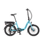
The inclinometer is mounted under-slung to the Kalkhoff's cross bar. The Kalkhoff was chosen because it is an 'old-school' machine not having any suspension. 30mm P-clips were moulded to suit the triangular section of Sahel's cross-bar.
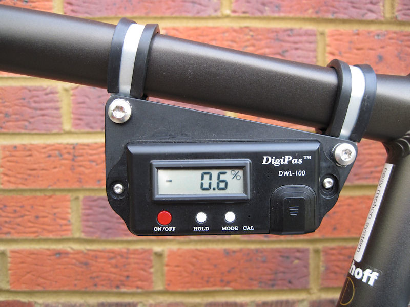
The inclinometer is bolted to a backing plate, with the front bolt in a curved slot to allow setting the unit to zero while on a pre-checked level surface.
Originally intended for building and ground-works, the DigiPas lacks any damping on the display. For that reason there would be no point in being able to read it whilst on the move, it would be constantly reacting to every undulation in the road. When comparing the value given in Google Earth, the machine had to be walked up or down the slope to find the 'spot'. I suspect Google Earth measures gradient between two points shorter than that of Sahel's forty-six inch wheel-base. Micrometer accuracy was neither expected or required, just something a bit more realistic than my previously wildly inaccurate guesstimates of the hills around Swindon.
Referring back to Member Johnc461165's useful tip of using the 'directions' facility in Google Earth to establish an elevation profile of a given route between post-codes. Obviously, this can only be used when the ride is on metalled road, for off-road the 'path' facility would be used instead.
Just for fun.
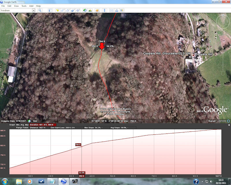
I would imagine just about everybody is aware of the annual cheese rolling competition on Cooper's hill in Gloucestershire. The route was traced using the 'path' facility, the elevation profile then selected. This shows the steepest part of the hill at 34%. By the time the contestants reach this spot, already having a fair bit of momentum, they tend to 'take off' followed by a series of bone-breaking end-overs, finally coming to rest in the arms of the paramedics at the bottom.
In order to satisfy Googles requirements when copying screenshots in a not-for-profit posting, the image could not be cropped. Quality is not so hot, but you can just about see the 34% spot on the hill.
Gloucestershire Cheese Rolling 2009
The DigiPas DW-100 digital protractor/inclinometer was purchased last year and mounted to an eight feet long I-beam straight-edge. This was used in laying a large paved area at a friends home.
The inclinometer is mounted under-slung to the Kalkhoff's cross bar. The Kalkhoff was chosen because it is an 'old-school' machine not having any suspension. 30mm P-clips were moulded to suit the triangular section of Sahel's cross-bar.
The inclinometer is bolted to a backing plate, with the front bolt in a curved slot to allow setting the unit to zero while on a pre-checked level surface.
Originally intended for building and ground-works, the DigiPas lacks any damping on the display. For that reason there would be no point in being able to read it whilst on the move, it would be constantly reacting to every undulation in the road. When comparing the value given in Google Earth, the machine had to be walked up or down the slope to find the 'spot'. I suspect Google Earth measures gradient between two points shorter than that of Sahel's forty-six inch wheel-base. Micrometer accuracy was neither expected or required, just something a bit more realistic than my previously wildly inaccurate guesstimates of the hills around Swindon.
Referring back to Member Johnc461165's useful tip of using the 'directions' facility in Google Earth to establish an elevation profile of a given route between post-codes. Obviously, this can only be used when the ride is on metalled road, for off-road the 'path' facility would be used instead.
Just for fun.
I would imagine just about everybody is aware of the annual cheese rolling competition on Cooper's hill in Gloucestershire. The route was traced using the 'path' facility, the elevation profile then selected. This shows the steepest part of the hill at 34%. By the time the contestants reach this spot, already having a fair bit of momentum, they tend to 'take off' followed by a series of bone-breaking end-overs, finally coming to rest in the arms of the paramedics at the bottom.
In order to satisfy Googles requirements when copying screenshots in a not-for-profit posting, the image could not be cropped. Quality is not so hot, but you can just about see the 34% spot on the hill.
Gloucestershire Cheese Rolling 2009
Last edited:
")