The Ching Challenge and Tour of Britain Ride

Conal

Pedelecer
Sep 28, 2007
228
2
Now back to the Ching Challenge!

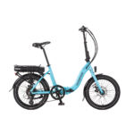
This thread is veering dangerously close to previous negative posts. To bring it back to the point, I recently asked Ching (he suggested I drop the Mr) if he felt my derestricted Ezee Forza would drain the battery more than if it was restricted if it was travelling at 15.5 mph or less and all other factors were equal. He stated that the power use would be identical in restricted and derestricted modes. If I can manage the Ching Challange on the Sunday and I travel with other cyclists at the same speed then the only differing factors will be the riders weight, the weight of the bike (the tyres?), the extra batteries, and the "ability" of the bike itself. As I have said before on this forum this ride must give us a good opportunity to measure the strengths and weaknesses of the different bikes. I would be willing to rerestrict it for the day although from what I have read other riders with recently purchased bikes will be able to obtain power assist at speeds greater than 15.5mph.

Conal
 
Last edited:

fishingpaul

Esteemed Pedelecer
Sep 24, 2007
871
86
The best thing available is what suits you best,after buying four electric bikes i am finally happy with the torq 2,it suits my needs perfectly, however other bikes may suit other riders better.
 

Conal

Pedelecer
Sep 28, 2007
228
2
Torq improvements

Paul

Have you been able to compare the Torq2 to the Torq1, Forte or Forza? Do you know how the the "improvements" actually show in your riding experience? Increased battery range, more power up hills, lighter bike, better ride?

Conal
 

Tiberius

Esteemed Pedelecer
Nov 9, 2007
919
1
Somerset
Hi guys,

I promised Ching that I would look into the navigation for the ToB ride. Coops, ElephantsGerald, I know you did some work plotting the course. Have either of you got it in a form that can be printed out, or loaded into a GPS.

Next questions. What form of route printout do people prefer when cycling? A narrow route strip, a section of chart, a list of turns? What about GPS for cycling. Is there a good cycle model that would do this job, or are they too much bother for this sort of work?

Nick
 

JamesC

Esteemed Pedelecer
Sep 1, 2007
435
5
Peterborough, UK
Hi guys,

I promised Ching that I would look into the navigation for the ToB ride. Coops, ElephantsGerald, I know you did some work plotting the course. Have either of you got it in a form that can be printed out, or loaded into a GPS.

Next questions. What form of route printout do people prefer when cycling? A narrow route strip, a section of chart, a list of turns? What about GPS for cycling. Is there a good cycle model that would do this job, or are they too much bother for this sort of work?

Nick
Hi Nick

I replotted the route kindly provided by Coops on Google Maps into Memory Map software on my PC. I am not directly in touch with the Tour of Britain to verify the route, particularly the absoloute position of the start and finish lines, but it is detailed in all other respects.

I use a SatMap on the bikes, mounted at the very top end of the crossbar on either the Torq or ProConnect.

The SatMap is very different from a Garmin and by no means everyone's favourite ! However, I enjoy it a lot for cycling in the style of a rambler / explorer.

So my normal use is to head off without a preplanned route, following my nose whilst the SatMap keeps an eye on exactly where I am, records where I have been and enables me to download that route into my PC at the end. Along the way, it provides me with distance travelled, average speed, ascent etc.

Unlike a Garmin, the SatMap already contains a disk with the Ordnance Survey maps of the area (the more you pay, the bigger the area), so it is not neccessary to download a section of mapping from the PC to see where you are.

When you do choose to preplot a route on Memory Map (or other mapping software), then the route is uploaded from the PC to the SatMap as a .gpx file.

If you send me a PM with your email address, I can send you the exported route from Memory Map.

One gentle word of warning is that Memory Map came out with much more climbing on the stage than Coops had calculated !! Sadly, it is more than I could handle in a single day on either of my bikes, but I am looking forward to hearing the details, particularly for the Torq 2.

James
 
Last edited:

coops

Esteemed Pedelecer
Jan 18, 2007
1,225
1
Manchester U.K.
Nick - The Google maps plot of the route I made was fairly rough but can be exported from there as a GPX file, which was how Elephants transferred it to Bikely. I don't have it in any other form, and sadly I'm not satnav/emap literate in the least! Though you may be able to download or print it somehow from either of those sites if you want (Bikely not working for me at the moment so I couldn't check there, but the google map has an option to 'print map') but James' replotted route is possibly more accurate in terms of topographical profile & total ascent, so that might be a better bet for sat nav or electronic map users :).

James - I'm glad to hear you've made some use of the initial plot of the route :). I'm not surprised your replot of the route came out with more climbing than the Gmaps/Bikely estimate, which probably suffer the same limitations of sensitivity to marker positions as Sanoodi in terms of gradient/climb calculations, and as I was limited by only a rough guide to the contours of the route I couldn't plot at the best points - there was over 200m more climb in the more detailed 2nd plot than the first, so I was aware it would always likely to be quite an underestimate!

Can you say how much more climbing it came out as on Memory Map? I'd be interested to hear how much more!

Hopefully the longest and steepest gradients (taken from the OS map) are roughly correct...:eek: :)

Stuart.
 

Tiberius

Esteemed Pedelecer
Nov 9, 2007
919
1
Somerset
OK, it sounds like gpx is the format to use as the common point. I presume from that we could print out guides (with the right software) or load it into a gps (with the right gps).

I have 3 or 4 Garmin gps devices around, but they are set up for cars and aeroplanes and not really the best for the job. The ground maps I have in them certainly don't show anything like the topo detail needed. I can't upload a gpx file to the gps device itself, but I can probably view it on the PC software that came with one of them.

James - I tried to PM you but the system wouldn't let me.

Nick
 

Django

Esteemed Pedelecer
Feb 11, 2007
453
1
Mr Ching you are becoming boring with your desparate attempts to undermine the kalkhoff range. From what I remember 50c said they would not compete as you were insisting on 4 batteries and they wanted to use only 3. That should give you a clue about a range which is well documented and based in fact.
Yes, that was an odd response. Why not simply use three batteries to Mr Ching's four? Game, set and match!
 

JamesC

Esteemed Pedelecer
Sep 1, 2007
435
5
Peterborough, UK
James - I'm glad to hear you've made some use of the initial plot of the route :). I'm not surprised your replot of the route came out with more climbing than the Gmaps/Bikely estimate, which probably suffer the same limitations of sensitivity to marker positions as Sanoodi in terms of gradient/climb calculations, and as I was limited by only a rough guide to the contours of the route I couldn't plot at the best points - there was over 200m more climb in the more detailed 2nd plot than the first, so I was aware it would always likely to be quite an underestimate!

Can you say how much more climbing it came out as on Memory Map? I'd be interested to hear how much more!

Stuart.
Hi Stuart
Using Memory Map on the 1:50k ordnance survey with 550 waypoints around the route, the overall distance came out at 120 miles with 10,186 ft of ascents and 10,487 ft of descents.

I started the route at the crossroads in the centre of Chard (height 324 ft), and finished it beside the roundabout on the seafront at Burnham-on-Sea (height 23 ft). These may be a little bit away from the actual start and finish lines.

Along the way, the highest point is about 1370 ft coming at the 62 mile point with some ups and downs for the next 15 miles. Early on, Staple Hill goes up to about 1000 ft and late on, after about 102 miles, there is a climb to about 800 feet. Looking at the profile, an overall figure of 10,000 ft of ascent does not look unreasonable.

It is a good challenge, and I hope WaiWon Ching, Tiberius and Conal get a good day for it. My range is more like 50 miles with 1500/2000 ft of ascent, preferably with less steep climbs.

James
 

coops

Esteemed Pedelecer
Jan 18, 2007
1,225
1
Manchester U.K.
Thanks James - that is much more climbing than the Gmaps/Bikely plot! Around 3100m of ascent, though not unreasonable as you say and I should think your result is more accurate than the plot I made - errors and lack of precise detail in height change on the Gmap/Bikely plot might account for the difference.

My range is more like 50 miles with 1500/2000 ft of ascent, preferably with less steep climbs.
Thats a good range and ascent on a Torq1 - I also prefer less steep climbs!

I agree its a good challenge, not least to moderate rider contribution so that it lasts as long as the batteries! I also wish those taking part good weather and a fair wind for the trip :).

Stuart.
 

riggo

Finding my (electric) wheels
Jun 12, 2007
9
0
Dorset UK
ching challenge (14/9/08) cancelled

Hi all,

I have decided to cancel the Ching Challenge on 14/09/08 as only 2 people have registered, i'm not total surprised as i have only had six weeks to organize it, 3 of which i was away on holiday. I will be happy to do something for next year at the same time. Meanwhile myself and David Henshaw are going to do the course to get some bench mark data.


thanks

Paul
 

Tiberius

Esteemed Pedelecer
Nov 9, 2007
919
1
Somerset
On the other hand, the ride on Wednesday 10th is going ahead. Just about everything seems to be in place. Even the weather forecast is not too bad.

The attached file shows where we are going; it has been prepared with help from other members of the forum, especially JamesC. It should be readable by anyone with suitable gps software.

The end of the route for the actual ToB stage looks like a car park somewhere in Burnham on Sea. Optimistically perhaps, for our trip, I have moved it 500 ft to the esplanade.

Nick

PS. Edited to add: Overview and altitude profile on the TofB website herehttp://www.tourofbritain.co.uk/images/therace_stage3/index_page/overview_and_profile_pdf_stage_3.pdf
 

Attachments

Last edited:

coops

Esteemed Pedelecer
Jan 18, 2007
1,225
1
Manchester U.K.
I hope you all get the forecast dry 1 day 'window' between rain fronts tomorrow, not too bad-looking as you said Nick, looks a bit of a headwind for the first half or so but once you pass South Molton you'll have a helping & probably strengthening tailwind hopefully as you head over the big stuff on exmoor & for most of the 2nd half, including the run in to the finish. :)

Have a good trip everyone, and for any interested onlookers with freeview the highlights of today's Tour of Britain Stage 3 race on the same route are on ITV4 at 8pm tonight (Tuesday 9th Sept).

Stuart.
 
Last edited:

stokepa31_mk2

Esteemed Pedelecer
May 7, 2008
381
0
I hope you all get the forecast dry 1 day 'window' between rain fronts tomorrow, not too bad-looking as you said Nick, looks a bit of a headwind for the first half or so but once you pass South Molton you'll have a helping & probably strengthening tailwind hopefully as you head over the big stuff on exmoor & for most of the 2nd half, including the run in to the finish. :)

Have a good trip everyone, and for any interested onlookers with freeview the highlights of today's Tour of Britain Stage 3 race on the same route are on ITV4 at 8pm tonight (Tuesday 9th Sept).

Stuart.
Yes good luck everyone. Stay safe out there and may the amps be with you.
 

flecc

Member
Oct 25, 2006
52,826
30,388
Just been watching the pros riding the stage. Best of luck to the participants tomorrow, at least your weather will be better than today.
.
 

stokepa31_mk2

Esteemed Pedelecer
May 7, 2008
381
0
Just been watching the pros riding the stage. Best of luck to the participants tomorrow, at least your weather will be better than today.
.
Mile Hill looks like quite a challenge! Its hugely impressive how these guys manage to sustain that sort of punishment.
 

flecc

Member
Oct 25, 2006
52,826
30,388
Yes, they really were heroic in the way they climbed the worst stretches Paul. Hopefully motors will make life easier tomorrow.
.
 

Tiberius

Esteemed Pedelecer
Nov 9, 2007
919
1
Somerset
Hi Everyone,

I'm sure others will be along with reports soon, but here's a quick one for our eager readers.

It was an absolutely cracking 24 hours. Good company, really good fun, starting the evening before in the hotel. And we did some serious e-biking too.

For most of the ride, there was a group of four that I was in, and two more riders out ahead. We managed to do most of the course, we did all the dramatic hill climbs and descents over Exmoor, but we ran out of time, daylight and weather.

My bike developed an intermittent fault that became too much and I stopped at 98 miles, just outside Bridgwater. The others carried on to Bridgwater at 105 miles and then called it a day. By then they were riding in poor light, and in the rain. The bit from there to the official end is level and on main roads so it's not challenging but wouldn't have been safe to continue.

The Torq1 is supposed to be not good at hill climbing. Well, I got to the top of Exmoor on mine.

Full marks to Ching, the event was a damn good idea. At the end of it, we were all agreed that we'd do it again next year.

Nick
 

JamesC

Esteemed Pedelecer
Sep 1, 2007
435
5
Peterborough, UK
The Torq1 is supposed to be not good at hill climbing. Well, I got to the top of Exmoor on mine.

Full marks to Ching, the event was a damn good idea. At the end of it, we were all agreed that we'd do it again next year.

Nick
Well done - sounds excellent.

Next time I am near Exmoor, I will try the climb on my Torq1 to see if my legs can maintain the 9 or 10 mph that the motor expects.

James